Klin
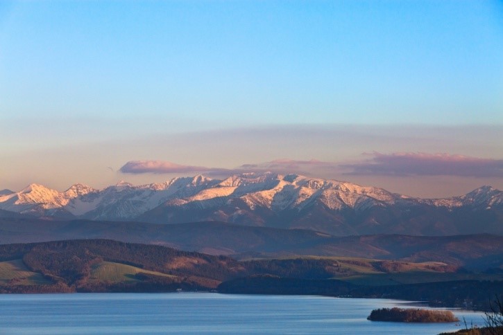
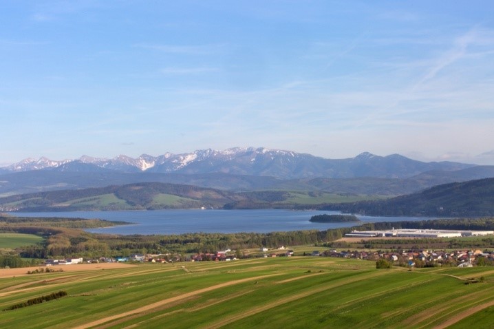
Klin was founded in the 16th century. In the past, the town was famous for cloth making, tailoring, blacksmithing, rafting and roof shingles making. There are remarkable natural sceneries with varied relief. One of the most popular areas is the area around the Sculpture of Christ, from where one can admire not only Klin and other surrounding villages, but also Lake Orawskie and Roháče. There is National Nature Reserve Peatbog in Klin where rich plant communities of raised bogs have survived. In winter, you can take advantage of the wide range of cross-country skiing trails.


Peatland in Klin
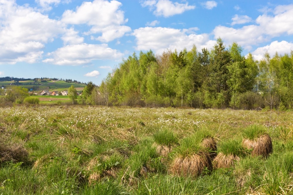
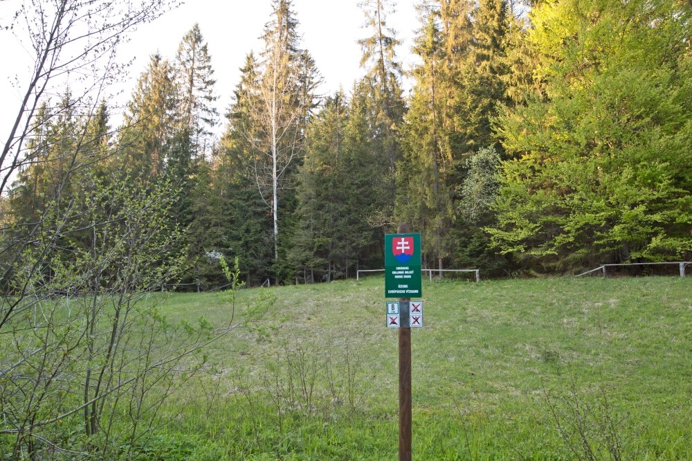
A smaller peatland of the transitional type is located near the village Klin. It was designated as the Klinské rašelinisko State Nature Reserve in 1967 (later the Klinské rašelinisko National Nature Reserve). Its area is currently enclosed with a spruce fence to prevent the entry of cattle and to define the territory of the reserve. It is the oldest protected area declared to preserve peatlands communities in Orava.
Read more
It is currently incorporated into the Zone B of Horná Orava Protected Landscape Area (Upper Orava), which is the first large-scale protected area in Slovakia, where the zonation was carried out. It is also part of Special Area of Conservation called “Rašeliniská Bielej Oravy” (Peatlands of White Orava). Klin peatland lies on the edge of the Orava Neogene Basin, on the banks of the Orava Reservoir, southwest of Klin, between the old and the new road connecting Námestovo and Klin, about 2 km from Námestovo.
The territory of the peatland lies at the lower edge of the southeast slope of Kunov Hill (744 m a.s.l.). The location is situated at an altitude of 615 to 620 m a.s.l., descending to the southwest. The Klin peatland is spread over 15.3 ha. It is a developed and preserved peatland of non-forest type, supplied only with rainwater. The water is then kept beneath the layers of humus and peat moss (Sphagnum), under the bog blueberry (Vaccinium uliginosum), but also in the numerous water areas situated to the west of the central part of the peatland. It can be easily recognized that many of them have been created artificially (vertical edges, predominantly the exact shape of a circle). Most of these water areas were created by water regulation but also by the extraction of peat used by locals to heat the dwellings.
Artificially created bog holes, also called “šlenky”, can be found in all Orava peatlands. These holes are currently at different stages of vegetation, especially filled with peat moss (Sphagnum), sedges (Carex) and common cottongrass (Eriophorum angustifolium). Since the water is necessary for peat moss, the holes serve as reservoirs of water and are very important for the conservation and existence of peatlands. They are also important for animals and plants that inhabit them. The Klin peatland is a raised bog, which in terms of ecological conditions is one of the most extreme ecosystems in Slovakia.
Raised bog was given its name according to the convex shapes, the hills or the loaves that form it. It creates an extremely acidic environment with a very low nutrient content that suits only a narrow and very specific group of organisms.
The largest area of the Klin peatland is covered by prairie sphagnum (Sphagnum palustre). The great part of plants grows in the form of groundcovers or shrubs, suitable for nutrient-poor environments and unfavourable living conditions. Another typical plant for the Klin peatland is low shrub with a pleasant aroma – wild rosemary (Rhododendron tomentosum). There also grows mountain crowberry (Empetrum hermaphroditum), bog-rosemary (Andromeda polifolia), large cranberry (Vaccinium macrocarpon), small cranberry (Vaccinium microcarpum), bog bilberry (Vaccinium uliginosum), bogbean (Menyanthes trifoliata), marsh cinquefoil (Comarum palustre), few-flowered sedge (Carex pauciflora), creeping sedge (Carex chordorrhiza), bog-sedge (Carex limosa), slender sledge (Carex lasiocarpa), also hare’s-tail cottongrass (Eriophorum vaginatum), bog cotton (Eriophorum angustifolium), white beak-sedge (Rhynchospora alba) and others. Among the carnivorous plants, that replace nutrients from the soil with nutrients from the hunted insects, it is round-leaved sundew (Drosera rotundifolia), common butterwort (Pinguicula vulgaris) and lesser bladderwort (Utricularia minor).
Among the trees and spruces it is Scots pine (Pinus sylvestris), common spruce (Picea abies), silver birch, (Betula pendula), various species of willow (Salix), ash (Fraxinus excelsior), aspen (Populus tremula), and among the bushes and roses it is dog rose (Rosa canina) and common hawthorn (Crataegus monogyna).
To mention the animal species living on the Klin peatland, we should surely not forget the colourful butterflies, especially extremely rare moorland clouded yellow (Colias palaeno), whose caterpillars feed only by bog blueberry (Vaccinium uliginosum). It occurs only on three localities in Slovakia. The invertebrates are the most diverse group. There are several species of flies (order Diptera) and ants on the Klin peatland. The occurrence of several types of dragonflies is of great importance. Emerald spreadwing (Lestes dryas), azure damselfly (Coenagrion puella), blue hawker (Aeshna cyanea), large red damselfly (Pyrrhosoma nymphula), black darter (Sympetrum danae) have been spotted, and, in particalur, there was the only confirmed finding of northern white-faced darter (Leucorrhinia rubicunda) in Slovakia. Certain species of rare shellfish were also found on the Klin peatland.
Another group of animals which may be found at the Klin peatland are amphibians and reptiles, namely pool frog (Pelophylax lessonae), great crested newt (Triturus cristatus), viviparous lizard (Zootoca vivipara), grass snake (Natrix natrix), common European viper (Vipera berus), slow worm (Anguis fragilis). As for the birds, there are common snipe (Gallinago gallinago), whinchat (Saxicola rubetra), European stonechat (Saxicola rubicola), common rosefinch (Carpodacus erythrinus), meadow pipit (Anthus pratensis), tree pipit (Anthus trivialis), Eurasian magpie (Pica pica) and common linnet (Linaria cannabina). As for the mammals, species such as roe deer (Capreolus capreolus), red fox (Vulpes vulpes), least weasel (Mustela nivalis), stoat (Mustela erminea), beech marten (Martes foina) and various species of rodents and insectivores can be observed.
Peatlands of the Upper Orava
Upper Orava (in Slovak, Horná Orava) – the northern part of the Orava region, bordering Poland, is surrounded by the massif of the Orava Beskids, Oravska Magura and Western Tatras – Roháče. The mountainous areas surround a significant terrain depression, the Upper Orava Basin, which flows continuously into the Nowy-Targ Basin on the territory of Poland. Most of the Upper Orava area is located in Horná Orava Protected Landscape Area, which is the first large-scale protected area in Slovakia, where the zonation was carried out and is also part of the Natura 2000 as the Special Area of Conservation.
Read more
Upper Orava is exceptional not only within the Orava region, but also within the whole Slovakia, thanks to the existence of well-preserved and relatively large peatlands, especially at the border with Poland. The total area of peatlands in the Upper Orava region is about 800 hectares. In the past, this area was much larger, but deforestation, artificial drainage, and especially peat mining, reduced the number of peatlands. That’s why they became rare and threatened. In the Horná Orava Protected Landscape Area, the peatlands belong to the zone of nature conservation B. Among the most famous are the Klin peatland, the Beňadovo peatland the Mútne peatland, the Slaná Voda peatland and the Spálený grúnik peatland, the Tisovnica peatland, the Rudná peatland and the Sosnina peatland near Suchá Hora, which is the most extensive one.
The main source of moisture for peatlands is groundwater and rainwater. The water is then kept in the layers of peat moss (Sphagnum), under the bog blueberry (Vaccinium uliginosum) and in some cases also in the numerous water ponds. Most of these water areas are natural, but some of them were created by human activity, due to the drainage of peatlands, or by the illegal activity of locals who mined the peat. Artificially created bog holes, also called “šlenky“, are currently at different stages of vegetation, filled with peat moss (Sphagnum), sedges (Carex) and common cottongrass (Eriophorum angustifolium).
All the three types of peatlands that exist in Slovakia – raised bog (oligotrophic), fen (euthropic) and transitional peat bog (mesothropic) – are located also in the region of Upper Orava. Raised bog is one of the most extreme ecosystems in Slovakia. It has a very acidic environment with a very low nutrient content that suits only a narrow and very specific group of organisms and is predominantly supplied with rainwater. In particular, mostly acidophilous and hygrophilous plants, that do not require mineral nutrients, grow in this area. Fen is supplied with groundwater and surface water and is rich in nutrients and species. Transitional peat bog represents the transition between raised bog and fen.
The largest area of peatland is covered by prairie sphagnum (Sphagnum palustre), which works as a sponge that soaks and holds water, adjusts the pH and creates more suitable conditions for the growth of other plants. At the same time, it can hold water up to twenty times of its weight. The great part of plants grows in the form of groundcovers or shrubs, suitable for nutrient-poor environments and unfavourable living conditions. Another typical plant for peatland is wild rosemary (Rhododendron tomentosum). It is a low shrub with wooden sprouts and leathery leaves. Wild rosemary is interesting by its distinctive, pleasant aroma, which you can feel when you tear away the leaves or branches. There also grows bog blueberry (Vaccinium uliginosum), bog-rosemary (Andromeda polifolia), large cranberry (Vaccinium macrocarpon) and mountain crowberry (Empetrum hermaphroditum). All of these plants have the form of shrub similar to wild rosemary and their leaves have a top side covered with a waxy layer that prevents excessive evaporation of water.
Another group of plants, adapted to life on peatlands, are carnivorous plants. These plants have developed a unique method of supplementing nutrients and have increased their probability of survival. They attract insects into the digestive traps (the sticky fluid inside the flowers, on the leaves), where the insects stick, die and then the plant slowly spawns it. These carnivorous plants are round-leaved sundew (Drosera rotundifolia), common butterwort (Pinguicula vulgaris) and lesser bladderwort (Utricularia minor).
Other examples of peatlands species are bogbean (Menyanthes trifoliata), western marsh orchid (Dactylorhiza majalis), military orchid (Orchis militaris), early-purple orchid (Orchis mascula), water-arum (Calla palustris), many rare species of sedges (Carex), for example few-flowered sedge (Carex pauciflora), creeping sedge (Carex chordorrhiza), bog-sedge (Carex limosa), slender sledge (Carex lasiocarpa), also hare’s-tail cottongrass (Eriophorum vaginatum), bog cotton (Eriophorum angustifolium) and white beak-sedge (Rhynchospora alba). Particularly blooming white flowers of cottongrass and bog cotton change the peatland into a nearly white, as if snowy surface.
Here and there are small or larger groups of trees and bushes, growing especially in parts of the peatland with lower humidity. Scots pine (Pinus sylvestris), common spruce (Picea abies), silver birch, (Betula pendula), various species of willow (Salix), ash (Fraxinus excelsior), aspen (Populus tremula), and of the bushes and roses it is dog rose (Rosa canina) and common hawthorn (Crataegus monogyna) can be found there. Some of “dwarf” willows are very rare, such as swamp willow (Salix myrtilloides), which grows in Slovakia only in the Mútne peatland.
From the faunistic point of view, the Klin peatland, the Rudné peatland and the Sosnina peatland are important for the daily butterfly – moorland clouded yellow (Colias palaeno), whose caterpillars feed only by bog blueberry (Vaccinium uliginosum). It can be found only in one of these three locations in Slovakia. The invertebrates are the most diverse group. This group includes spiders, dragonflies, beetles and snails. Many rare and new species of spiders have been found in several Orava peatlands. Among the snails, a rare minute air-breathing land snail (Vertigo geyeri) lives in the Orava peatlands.
Amphibians and reptiles also occur on the peatlands. It is grass snake (Natrix natrix), common European viper (Vipera berus), slow worm (Anguis fragilis), viviparous lizard (Zootoca vivipara), Carpatian newt (Lissotriton montandoni) and pool frog (Pelophylax lessonae). As the birds, there is common snipe (Gallinago gallinago), whinchat (Saxicola rubetra), common rosefinch (Carpodacus erythrinus), meadow pipit (Anthus pratensis), Eurasian magpie (Pica pica) and black stork (Ciconia nigra).
The mammals also live or sporadically appear in the peatland, for example, roe deer (Capreolus capreolus), red bear (Cervus elaphus), wild boar (Sus scrofa), red fox (Vulpes vulpes), least weasel (Mustela nivalis), stoat (Mustela erminea), beech marten (Martes foina), various species of rodents (red squirrel (Sciurus vulgaris), murids (Muridae), rare northern birch mouse (Sicista betulina)) and insectivores (shrews and hedgehogs).
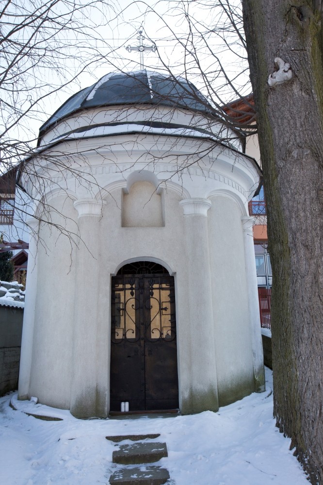
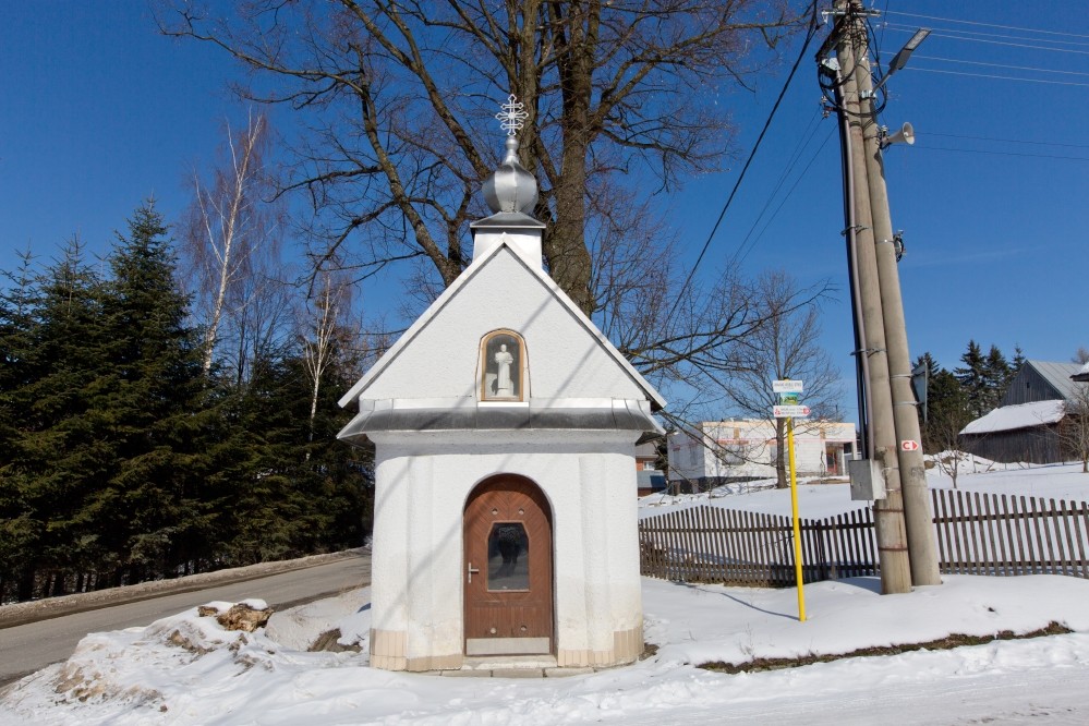
Chapel of St. Anthony of Padua
It is located in the lower part of the town of Klin. It is evidence of the linen history of the village. It has characteristic elements of the classical style. The chapel belongs to the group of linen mansions in the village. It was probably built in the first half of the 19th century.
History of the municipality of Klin
The village of Klin was established in the Upper Orava region. From the Middle Ages the whole region belonged to the Kingdom of Hungary – at first as part of Zvolen and later Orava Comitatus. The village of Klin was thinly populated area in the past. Local people were involved mainly in cattle and sheep breeding. They were liable to Orava County based in Orava Castle. The situation has changed in the 16th century when Thurzo family acquired Orava County into his ownership and thus launched an ambitious project of Orava colonization. During that period many villages were founded, Klin being one of them.
Read more
The establishemnt of the municipality of Klin was initiated by František Thurzo before 1567. The village founder and settler called „soltys“, who committed himself to establish a new village, was Jakub Kohút, born in Ústie. He brought a few families to the new village. The village was established in a submontane area and their inhabitants were exempted from obligations and liabilities for the first 16 years in order to make their farming smoother. At the same time Turkish and religious wars hit the country and the initial settlement and development of Klin was facing tough times. Therefore on 17 July 1613, Juraj Thurzo issued a new foundation charter. The village was founded according to the Vlach law. At the same time the forest district was set apart. The mention of vassal obligations is dated to 1623.
After the village was established, it was led by „soltys“ (founder and leader of the village) which was coming from Klinovský family. Members of this family were actively involved in a battle against Kuruc unit under Gašpar Pika who invaded Orava in 1672. As a result of these efforts, Klinovsky family was awarded with the nobility title. During Turkish and Kuruc wars the village of Klin was burnt out by Polish – Lithuanian army fighting for the emperor Leopold I. Habsbursky. The situation has changed in the 18th century and the village of Klin stopped being based on the Vlach law. Its duties and obligations were covered by the Urbar Regulation of Maria Theresa from years between 1770 – 1775. The function of „soltys“ was abolished and the village was led by an elected mayor and a local council.
The dwellers were engaged in agriculture and cattle and sheep breeding. Craftsmen and millers were also spread over the village. Linen weaving became the most important craft in the 18th century. Linen was cultivated in the village, then made canvas out of it and traded far beyond the borders of the region. The import of manufactured textiles in the 19th century affected the linen weaving and led to its decline.
After the revolution in 1848 – 1849 when the feudalism was abolished, former vassals were replaced by free farmers. The property settlement between Orava Compossessorate and inhabitants of Klin led to a long-term conflict which terminated by conclusion of the Urbar Agreement on 23 October 1875. The association of former urbarialists was in charge of farming on the land which Orava Compossessorate ceded to its former vassals. The association’s main source of income became a sale of wood. The association oprerated within the scope of its regulations during the Austro-Hungarian Empire, Republic of Czechoslovakia as well as after 1945. In 1958 it was abolished and was transferred to the administration of State forests. The urbarialists association renewed its activities in 1991.
The life of people was heavily marked by the First World War. A lot of men from the village lost their lives and many other were injured. The warworn inhabitants joined uprisings against the Austro-Hungarian Empire and contributed to its decline and establishment of Czechoslovakia. The Second World War and Slovak National Uprising were other tough challenges. In the fights against fascism a few inhabitants of the village were killed and injured as well. Movement of the front and liberation in 1945 caused a huge damage to people.
In the 20th century most people continued to be involved in agriculture and cattle and sheep breeding. The end of the Second World War brought many changes. Considerable efforts were made to establish an agricultural association. In 1973 most of the land in the village was administered by the state. The farmers became independant after 1991.
Due to a difficult social situation, many inhabitants of Klin were seeking employment outside the region. In the second half of the 19th century and in the 20th century, it was mainly USA, France, Belgium and Germany. After 1945 many people found employment opportunities in new factories and companies in the country. In 1950 a municipal enterprise was established in Klin, known as „Drobná prevádzka“, which operated in various working fields such as construction, locksmithery, carpentry etc. It contributed to different construction works and projects in the village e.g. building of the local market/shop, house of culture and water pipeline. Nowadays Klin is a dynamically developping municipality.
The elementary education was provided by the primary school called „ľudová škola“, founded in 1834. The law about compulsory education was introduced in 1869. The old school building from the 19th century was operational until 1928 when a new building started to be used. However its capacity was not sufficient and therefore children were attending school on a rotating basis. A building, despite its subsequent reconstruction, did not fulfil necessary requirements. In 1962 a new school building was constructed – recently renewed, expanded and modernized, it is used until present days.
The residents of the village have always believed mostly in the roman-catholic church. At first the municipality was affiliated to Namestovo and Zubrohlava chapelry. The autonomous chapelry in Klin was established later in 1998. The first consecrated place in the village was a chapel dedicated to Anton Paduansky in 1826. The chapel was rebuilt and enlarged in 1912. The next significant reconstruction of church took place between 1993 – 1997.
Another important cultural institution in Klin was the association called „Orol“, established in 1922. In order to cover its needs, the association built a house of culture called „Orlovňa“. The construction works were finished in 1927 and it was used for cultural events. In 1991 it was demolished and replaced by a house of culture which was built in 1980s.
Regarding the development of sport activities in the municipality, the establishment of sport club TJ Tatran Klin played a crucial role. It was dedicated mainly to football. The football playground was built in 1960s and has been functional until nowadays. Skiing is the most popular among winter sports. A ski-lift was built in 1990s together with a ski resort for cross-country skiing.
Weavers houses in Klin and in the surrounding area
Weavers houses and linen weaving architectural heritage in Orava is a unique cultural phenomenon. Weavers houses are dwellings constructed by weavers from Orava, in particular for residential purposes, but also for weaving manufacture, and mainly for the storage of goods. Weaving architecture also includes buildings of dyehouses and mangles, separate storage buildings and many other masonry or wooden buildings.
Read more
From geographical point of view, weavers houses were built in a so called weavers villages in the Upper Orava region. It covers a group of municipalities which are not always uniformly defined. These villages and towns were situated on the Slovak side of Orava region, such as Bobrov, Zubrohlava, Klin, Štefanov nad Oravou, part of Dolný Štefanov, and former municipalities of Slanica, Ústie nad Oravou, Osada and Hámre, now flooded villages. On the Polish side of Orava region, the weaving craft was developped mainly in Dolna Lipnica, but also in other municipalities.
The term of weavers houses („curia“) is linked to dwellings of noble and priviledged members of society. Therefore this designation is somewhat misleading, since the majority of weavers did not possess the title of nobility (with the exception of Bernolák from Slanica and Klinovsky from Klin). Noble and manor houses seem to have been one of the inspiration sources for builders of weavers residential buildings.
The weaving architecture was spreading over from the 18th until the early 20th century. This was related to the development, expansion and gradual decline of the weaving craft and business. Some weavers managed to make a fortune through their business and their new social status was expressed by grandeur of their home residence. Minor weavers sought to imitate them and applied a number of architectural features, although to a much lesser extent.
A typical weavers village or rather a small town called oppidum, was Bobrov. The trade with canvas was developped already in the 18th century. In 1732, the first mangle was most probably built there. In 1825/1826, there were 8 mangles in Bobrov, which was the most in today’s Námestovo district and a dyehouse was operational as well. Bobrov was exceptional also from the urban point of view. In addition to 5 mangles and a dyehouse in 1822, more than 38 houses were made of brick. Well-known weavers families in Bobrov were Kompaník, Belvončík, Koštialik, Vlošák and Odrobiniak. As a result of various factors, and mainly due to the construction of Orava Dam, there are nowadays only three houses in Bobrov which retained elements of weaving traditional architecture.
Another weaver village was Zubrohlava, a municipality located in the neighbourhood of Bobrov. The weaving architecture started to develop here also at the end of the 18th century. In 1788, Jozef Kunst, of Jewish descent, settled in the village and contributed to the construction of a mangle for Ján Tomaštík. In the 1820s, there were three houses of masonry construction in Zubrohlava, later their number increased. Well-known weavers families were Tomaštík and Kovalčík.
Nowadays we can find only one weaver house in its original state, the others were either demolished or reconstructed.
An important center of weaving craft in Upper Orava was Slanica. Together with Bobrov, they belonged to municipalities with the greatest number of weaving production facilities in the area. In 1728, the existence of two mangles with dyehouses is listed in the inventory of Slanica. In the 1820s, there were five houses and four granaries of masonry construction. Among families with important weaving tradition can be found Bernolák, Klinovsky and Gallas. The factory to dye fabrics of brothers Schiffer was also very well known. In 1953 and following floods, the municipality of Slanica disappeared below the surface of the water of Orava Dam. Other villages with significant impact on weaving architecture in Orava region faced the same fate. The inhabitants of two smaller villages Oravske Hamry and Osada, flooded by Orava Dam in 1953, were also involved in weaving. In Osada, weavers families of Bafčík and Ballo and in Hámre, families of Polačík and Grigel were living. Another important weavers village was Ústie nad Oravou. The first mangle and a dyehouse were established in 1775 by Kovalik family and another one by Kohut family in 1836. In 1849, twenty five families were engaged in weaving. The village was also flooded by Orava Dam and ceased to exist, with the exception of its cemeteries.
The town of Námestovo belonged to the major trading centers with canvas. It was given a privilege to trade with canvas in 1728. In 1776, Námestovo has been granted market privileges and became an oppidum – town. There were three mangles and dyehouses in Námestovo. In 1884, the guild of weavers was establishede in Upper Orava. Several weavers families were living there, among which the family of Murin occupied the most prestigious place. However, there is not much left from the original architecture of the town. This is due to movement of the front at the end of the Second World War as well as flooding of part of the town by Orava Dam.
Weaving was largely developped also in Dolny Štefanov, nowadays part of the municipality Štefanov nad Oravou. In the second half of the 18th century, a mangle together with a dyehouse were built there and belonged to the family Kovalik. In 1850, it stopped working. It stood in the vicinity of the so-called Palider manor house which was built in 1789 and ceased to exist only recently. Two other manor houses – Tholt and Pojtek – have remained until present. Among the most important ones were the families of Pojtek, Kovalík and Buček.
The weaving construction architecture has spread to other villages in the vicinity of the Upper Orava. One such facility is located in Vavrečka and another one in a polish town Chyžne.
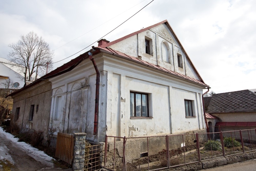
Although Klin did not belong to one of the most important centres of weaving architecture in Orava region, it should not be overlooked. The family of Klinovsky was involved in a trade with canvas already in 1728. In the 1820s, there was only one house of masonry construction. However the situation has quickly changed mainly due to the development of business. The families of Skyčák and Klinovský were known for their involvement in weaving. The family of Skyčák in particular, has become one of the most significant weavers families in Orava region with a number of well-known personalities. They built several weavers manor houses, one of which has recently been reconstructed. Out of all weavers houses in Orava region, most of them has been maintained in Klin and can be identified by visitors.
Weavers from Orava created a specific style of traditional building culture which reflected their unique lifestyle as well as culture and history of the region.
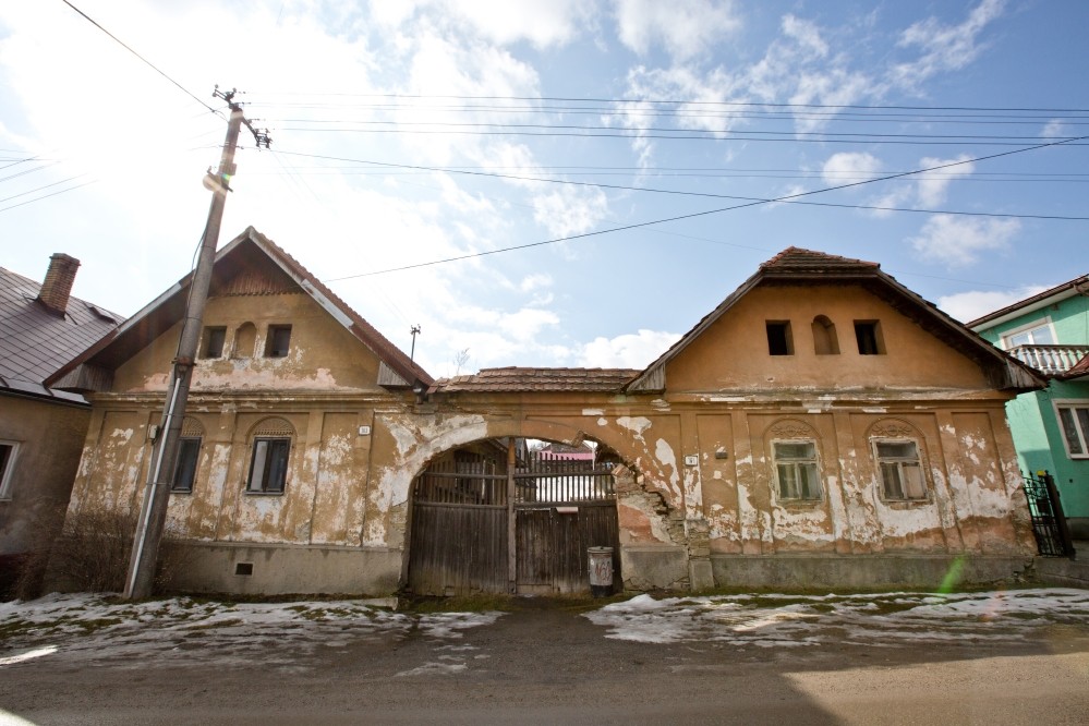
Linen property Hlavná 163 a 164
Two residential buildings with a shared yard are located in Klin on Hlavna Street, buildings were in the past used for linen industry. The facades are richly decorated with architectural curvatures. The buildings, built in the 19th century, are a monument to national history.
Linen property Hlavná 212
The oldest linen property in Klin is located near the center of the village at Hlavna Street. It was built in the first half of the 19th century. It has recently been carefully restored and can be seen in almost authentic form. In front of the property there is a pillar with a sculpture of St. John of Nepomuk. The building is a monument to national history.

Linen property Hlavna 217
This linen property in Klin is located near the center of the village at Hlavna Street. In spite of many modifications, it retains the preserved architectonic morphology that testifies to its original appearance. The building is a monument to national history. It was built in the mid-nineteenth century.
History of the Settlement of Upper Orava region
From the Middle Ages the territory of Orava region was part of Orava Comitatus that belonged to the Kingdom of Hungary until 1918. Most villages established during that period were located in the valley of Orava river and were liable to Orava County. A few villages belonged also to the lower nobility. The territory of current Upper Orava region was situated along the border with Poland. Unlike today, the border area between two monarchies was thinly populated. Various trade routes were passing by the border area where custom stations called „tridsiatok“ were located. At that time they were fulfilling the role of customs as we know them nowadays. A fee on all imported goods from abroad was collected and amounted to 1/30 of the cost of goods.
Read more
In the Middle Ages the dispersed settlement prevailed in the current district of Námestovo, comprising villages of Klin and Oravské Veselé. The shepherds involved in breeding of livestock, horses and sheeps, were the most common group out of the whole population. Shepherds were building their sheep farms and accumulating land for farming.
The situation started to change during a Renaissance period. In 1556, František Thurzo acquired Orava into his ownership. Orava County, whose administration was centralized in Orava Castle, comprised 32 thrall villages with annual revenue of 12 000 ducats. František Thurzo was aware of the development potential of his new county. Therefore he launched a colonization of Orava region which was quite extensive considering local conditions. This meant a long-term investment into land and population, in the sense of saying „Where people is, there is money“ (in latin „Ubi populus, ibi obolus“). He laid the foundations of work which was continued by his successors, in particular his son Juraj Thurzo. The colonization by Thurzo family led to low population density at the border of the Kingdom of Hungary and Poland. Terms Upper and Lower Orava were created due to colonization. By the end of the 16th century, 42 new villages were established. At the beginning of the 17the century, the county of Thurzo comprised 83 municipalities, out of which 80 were thrall villages and three towns „oppidum“ (Trstená, Tvrdošín a Veličná).
The establishemnt of the municipality of Klin was initiated by František Thurzo before 1567. The village founder and settler („soltys“) who committed himself to establish a new village was Jakub Kohút, born in Ústie. He brought six families to the new village. A new surname „Klinovský“ was assigned to Jakub Kohút and to his family shortly after their arrival to Klin. Also newly established estates took name after their settlers (known as „rale“).
The colonization of less populated areas in Orava county continued also after the Thurzo family died out and Orava Compossessorate was created. One of newly founded municipalities was Oravské Veselé. The countess Helena Illésházy, born Thurzo, issued to its founders called „soltys“ – Roman Námestovský and Matej Osčanda, a charter on establishment of the village.
„Soltys“ was entrusted with foundation of new villages. They were very enterprise people who concluded agreements with relevant feudalists – owners of Orava County. They committed to establish a new village and to gather settlers – colonists. As a result, they were granted „soltystvo“, hereditary rank of a mayor – leader of the village with a right to run a mill. Newly founded villages were entitled to protection period of mostly 16 years during which their inhabitants were exempted from tax burden and labour obligation. This time period was supposed to be sufficient in order to create a solid basis of their economy and to become independent. New villages were established in mountains and in a broken terrain with lack of soil quality, therefore this was a very challenging task.
The colonization of Upper Orava and establishment of new villages was taking place in difficult times of Turkish wars and anti-Habsburg uprisings. The Orava region was becoming repeatedly a battle field, in particular during the uprising of Imrich Thököly and František II. Rákóczy. Even at times when the region was not a direct fighting zone, it had to face economic and social problems caused by the war. This affected newly founded villages which were falling into difficulties. Klin got into a very troublesome situation as well. In 1608 the village was almost completely uninhabited, with the exception of the only one taxable estate. Therefore on 17 July 1613, its lord, count Juraj Thurzo, issued a new foundation charter to the village. A new „soltys“ became Jakub Kohút Klinovský who was in charge of the re-foundation of Klin and was granted a period of 10 years of tax exemption. Inhabitants of the village Oravské Veselé were also facing significant problems. Their lord, count Štefan Thököli, who was a director of Orava Compossessorate, issued a new foundation charter in 1657. A new „soltys“ became Juraj Námestovský, also called Veselovský. The process of colonization and foundation of new villages was completed at the turn of the 17th and 18th century. It was accomplished by the director of Orava Compossessorate at the time, count Juraj Erdödy junior. When estates‘ uprisings came to its end, he managed to improve economic and social situation of people. The newest municipality in Orava region has become Oravská Lesná, originally called „Erdútka“ in honor of the count Juraja Erdödy.
Newly established municipalities managed to settle during the 18th century and inhabitants were obliged to fulfil duties towards their lord in the same way as older villages. In 1770-1775 Maria Theresa, ruler of the Habsburg, came up with the Urbar Regulation. New obligations of vassals remained in force until the feudalism was abolished following the revolution in 1848 – 1849. The property settlement between Orava Compossessorate and its vassals lasted a few centuries. In order to administer the property ceded to villages by feudals, the associations of former urbarialists were founded at the end of the 19th century. These associations are active until nowadays, except for the second half of the 20th century when most of the land was administered by the state.
The agriculture and livestock breeding provided a living for most inhabitants ever since ancient times. People who lived in the village were working in different areas, like craftsmen, millers, blacksmiths, girdlers, weavers, traders, etc. This life style changed more significantly only after the Second World War. During this period a new culture of living was created and the traffic infrastructure was built. New elements incorporated in all amenities reflected a spirit of the modern society.
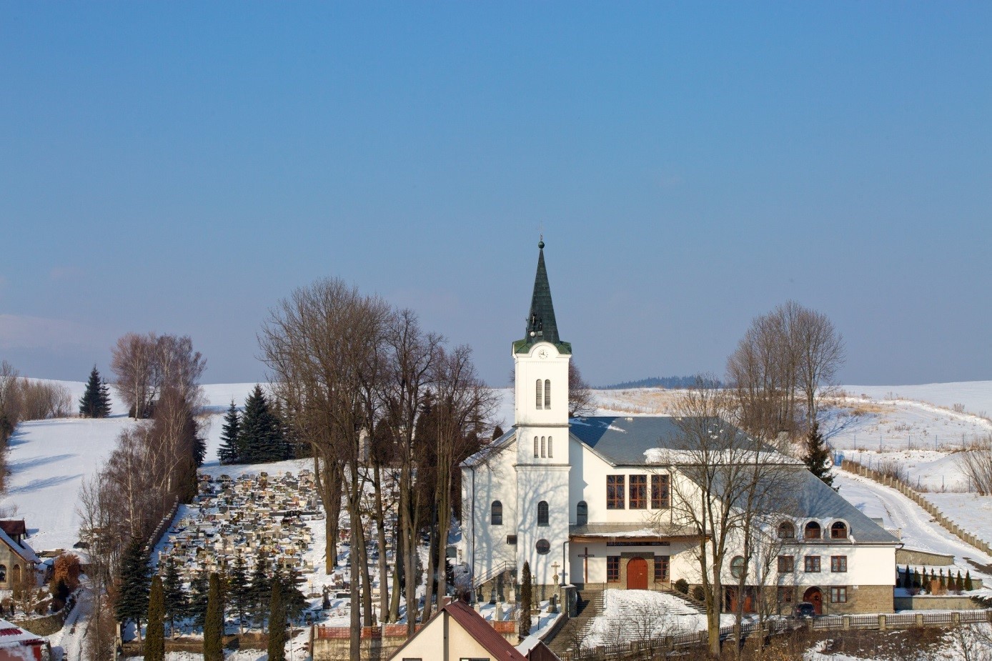
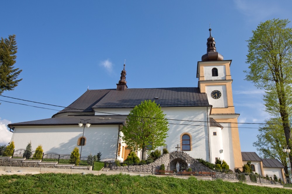
Church of St. Anthony of Padua
Originally, there was a chapel from 1826 dedicated to St. Anthony of Padua. At the beginning of the 20th century, the chapel was expanded and a tower was added. Between 1993 and 1997, the church was rebuilt according to the project of Marián and Anna Gočovcov to the present form. In today’s church there are incorporated parts of the older building and the original historical altars were preserved. In 1998 Klin became a separate parish.
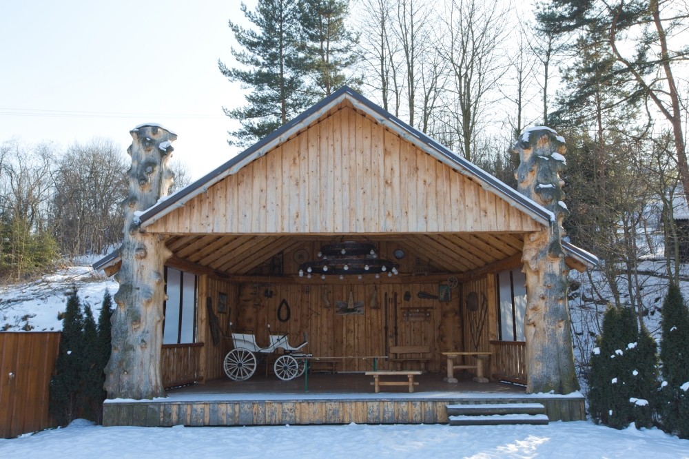
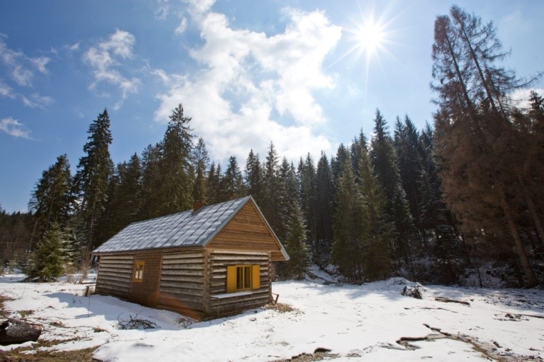
Amphitheater and wooden hut
The whole area around the hut serves not only as a restaurant, but it is also a place where various social, cultural and sporting events are organized. Folklore performances, dance entertainments, boxing tournaments, as well as Klin’s traditional breeders’ exhibitions are common.
Protected area Ťaskovka
The first nature reserve created in 1995 included an area of 0.6718 ha. On its area there is a tuff spring with travertine heaps, as well as peatbog with endangered species of plants and animals. The protected area is located in the upper part of the village near the Ťaskovka housing estate.
Oravske Vesele – history
The village Oravske Vesele was established in the neighbourhood of a mountain Pilsko, in a forested terain. The surrounding in which the village started to exist, had been since midieval times a part of Orava seat, a part of Hungarian empire. It was situated in hungarian-polish border area that was in Middle Ages scarsly inhabitted. People lived mainly as shepherds of livestock and sheep, they made sheep huts. In the areas woods were disforested and they formed fields and pastures. Local people were mostly liegemen of Orava castle.
Read more
When in 1556 Frantisek Thurzo got Orava a county and Orava castle, he started to realize a systematic policy of colonization. Hie sons continued in his style and his son Juraj Thurzo, and later Orava composesorat which was found after the Thurzo family extinction in male tale. The fond charter of newlyfound Oravské Veselé was inscribed by a count Helena Illésházy, nee Thurzo, who was a wife of a count Gaspar Illeshazy, a director of Orava composesorat. Administrators who were authorized to establish a new village and find incomers, were Roman Namestovsky and Matej Osčanda from Poland.
A new village building was a complicated process linked with many problems. And therefore a director of Orava composesorat, a count Stefan Thokoli, inscriebed in 1657 a new fond charter, where Juraj Namestovsky was delegated as an administrator who started to use a Suriname Veselovsky. He owned a residence with a timber-mill, a mill and a piece o fland. The oldest delimitation of village land comes from 1665. Thi delimitation was connected with a long-lasting problems about the land with Namestovo.
In documents from 1677 and 1696 we can find that in Oravske Vesele there were seven farmhouses /called „rale“/ owned by: Subak, Stas, Kafias, Solka and Plavnik. First craftsmen in the village were a blacksmith and a weaver. Another craft was a mill. In 1677 there were three mills. Most of people lived on agriculture and domestic animals. They used three-field system in cultivating land /winter crops, spring crops and barren/. The village did not have a sufficiency of their pastures and therefore it hired land from Orava composesorat in locations of Magurka, Dlha Bucina, Priehyba and so on. During 1770 – 1775 by emperor´s order of Maria Terezia Oravske Vesele had a land regulation. This regulation forbid a hereditary tithing man and she initiated an election of a tithing man, a notary and a community council.
Inhabitants of Oravske Vesele were mostly of Roman Catholic religion. First the were an affiliated branch of a parish Namestovo and since 1706 they belonged to Rabca. Oravske Vesele became a separate parish in 1786. The first wooden church, dedicated to St. Elizabeth, was built in 1656. Later it was given to Evangelic church as Orava composesorat was evangelic. In 1688 the church became again Roman Catholic and it was dedicated to St. Elizabeth. In 1690 a bell tower was built. In 1812 a new bricked church was built and later in 1833 a house for a priest. The church was reconstructed in 1929 and then in 1964-1965. There are also som chappels in the village and a few crosses.
After revolution in 1848-1849 a feudal system was banned. Property settlement between Orava composesorat and its previous liegemen was finished with an agreement that was signed 12. May 1873. This was the beginning of making an alliance of previous liegemen. The alliance started with the land and woods. After the second world war the woods were taken by state and the alliance was banned. After the revolution in 1989 the alliance could start its activity again.
The World War I. meant hard time for inhabitants of Oravske Vesele. Apart from deads in a front, the war caused big economical and social problems. Epidemic of a Spanish flu had very bad consequences in lives of the village. Inhabitants rose in revolt against monarchy and welcomed an initiation of Czechoslovak republik.
In interwar time most of people lived on agriculture and keeping domestic animals. They had their annual fair of livestock. Some residents ran their crafts and service. There were 4 mills in Oravske Vesele. But the land culd not earn all inhabitants living and many people looked for work abroad, mainly in USA, Germany, France and Belgium.
School in Oravske Vesele was established in 1790. Since 1869 compulsory school attendance was applied. A school building was rebuilt in 1900 and a new threeclassed building was built in 1926. The alliance of previous liegemen devoted money too. In 1930 the school had 6 classes. In 1943 two separate schools were made. In 1939-1945 war influences the village life. Inhabitants participated in anti-Fascist rebellion and Slovak Nationa Uprise. During the passing front the village was very demaged.
In 1952 a new fire station was built for local firemne who worked there since 1936. The fire station was a man-function building where a municipality, a post, library and a shoe shop were run. In 1993 the building was reconstructed. An affiliated branch of bank and shops got a place there too. In 1958 Oravkse Vesle was connected to public electrical network. A cultural centre was built in 1972-1982. The village missed water sources. This problem was solved with a construction of village water main that was projected in 1983-1998.
Agriculture after the second world war was changing. A new system preferred a collective farming and cooperative farms. In 1962 there was Statny majetok /a cooperative farm/ established with an area cca 500 ha. Up to 1978 all farmer got in it. Various work in the village was done by the local firm Drobna prevadzka that was established by a village municipality. Short after the war school started to be state and a system of education was changed. In 1955-1957 a new school building was built. Health care was provided by a local health centre. Its buildings were finished in 1970 and since then modernized. The health care is provided for Oravske Vesele and Mutne.
After the tender revolution in 1989 and beginning of the Slovak republik in 1993 Oravske Vesele was changed into a modern Orava village.
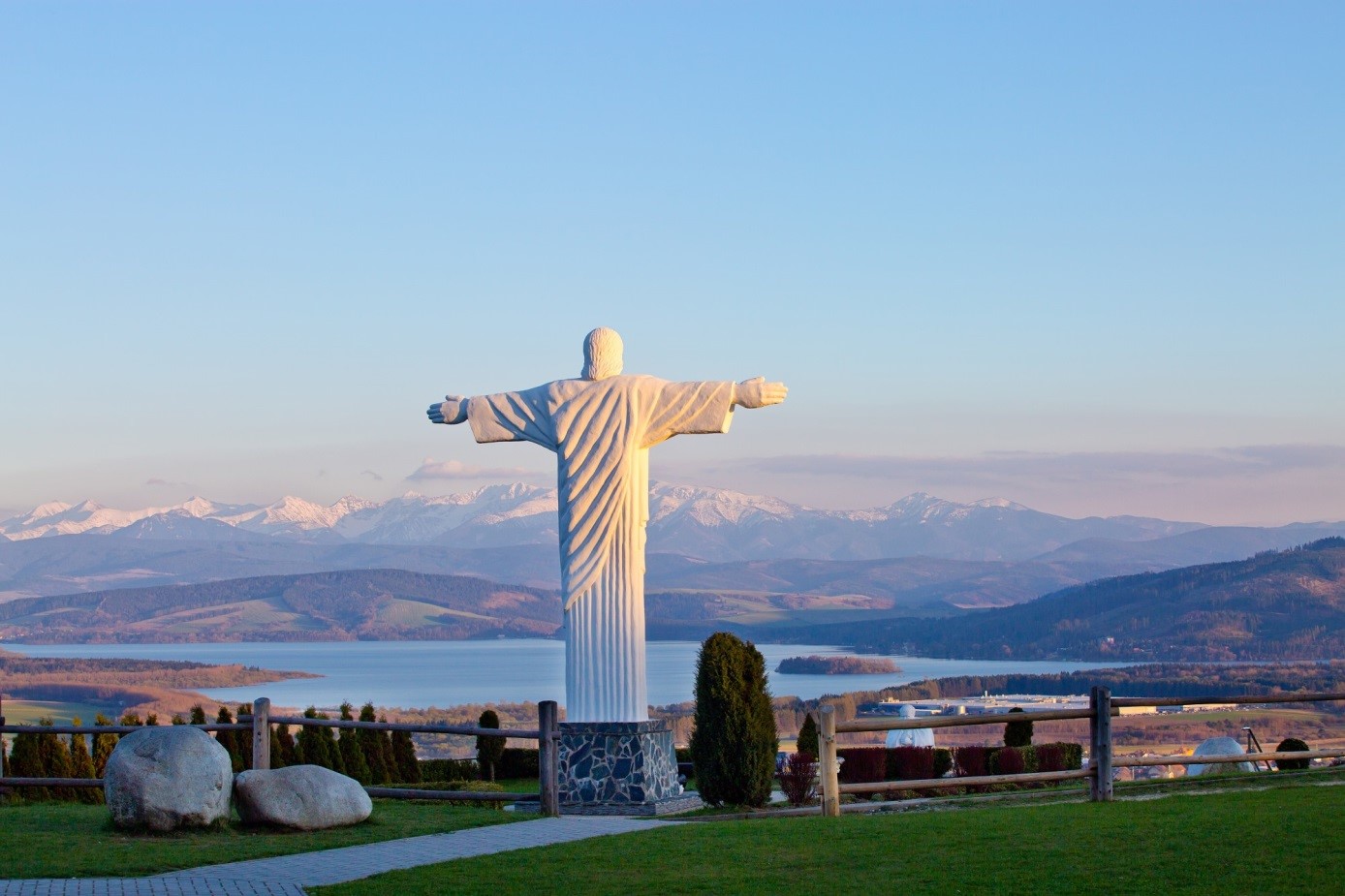
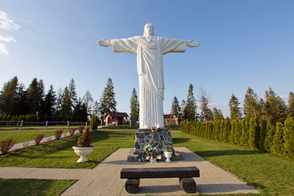
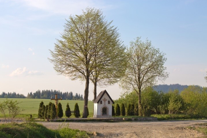
Area around the sculpture of Christ
This popular place is a private project of the inhabitant of Klin Jozef Sroka. In the center there is the statue of Jesus Christ, created in 2007 by sculptor Jozef Ganobjak. The statue is 9.5 meters high and the statue with the base weighs about 23 tonnes. Around the statue, more buildings and works were added. A statue of the kneeling John Paul II, Chapel of Mercy of God, a chapel with a statue of Virgin Mary, and many other objects were built there.
Chapel Vahanov
There was a wooden cross on the top of the Vahanov. At the turn of the 20th century it was replaced by a metallic one. In 2007 a gazebo was built and a few years later a stone chapel with a sculpture of St. Anthony of Padua was built too.

Nature of the Upper Orava
Upper Orava (in Slovak, Horná Orava) – the northern microregion of the unique and diverse region of Orava, borders with Poland. It is surrounded by the mountains of Orava Beskids, Orava Magura and Western Tatras – Roháče. It is northerly situated region of Slovak Republic, where the northernmost point of country – Modralová – is also located. Upper Orava’s northern position is reflected in a rough, cold and humid climate. The highest annual amount of rainfall in Slovakia is received here – summer is rainy, winter is severely frosty with high snow cover.
Read more
Regarding nature protection, most of the area is located in Horná Orava P rotected Landscape Area and is also a part of the Natura 2000 network as a Special Area of Conservation. The eastern part of the Upper Orava microregion is located in the Tatra National Park, more specifically in Roháče Mountains. The most significant hill situated in this microregion is Osobitá (1687 m a.s.l.). Pilsko and Babia hora are the most important hills of the Orava Beskids on the borders with Poland. Babia hora with an altitude of 1725 m a.s.l. is also the highest peak of this third highest mountains in Slovakia. The Orava Beskids form the border between drainage areas of the Baltic Sea and the Black Sea. The Orava Beskids are part of the Western Carpathians.
Geologically, Upper Orava is predominantly a flysch zone, consisting of little permeable layers of clay and sandstone that aroused in Tertiary Period. The area of Roháče is made up of granites, dolomites, limestone and sandstone. This geological composition generates much more varied rock formations than pure flysch territory. The dominants of the Orava Beskids – Pilsko and Babia hora as well as Oravská Magura are made up of the so-called Magura Sandstone, which rises to the surface especially in the top part of Babia hora. There are few stone fields visible in Pilsko and Babia hora, which were created by frost weathering. Soil erosion caused by rain still happens today, and it is typical by soil scuffing, rinsing or sliding.
The Orava-Nowy Targ basin stretches to the south of the Orava Beskids and contains artificial water reservoir called Orava dam. On the eastern side of Upper Orava, under the hill of Osobitá, there is the Oravice basin, created by the erosion of the Oravica River and its tributaries. From a climatic point of view, Upper Orava falls within the cold climatic zone, with two districts – a cold mountain zone with an average July temperature of 10-12 °C and a mild cold zone with an average July temperature from 12 to 16 °C. Average annual rainfall totals are 700 – 1600 mm. In terms of soil cover in Upper Orava, Cambisols dominate, being acidic to severely acidic and nutritionally deficient. The composition of the soil cover is reflected in species composition of the plant and animal components.
According to the phytogeographical classification, Upper Orava region belongs to the area of West Carpathian Flower (Carpaticum occidentale), subarea of West Beskids Flora (Beschidicum occidentale) and district of Western Beskids. A considerable part of the territory is covered by forests of beech – spruce and spruce altitudinal zone and also with spruce monocultures. There are also primary forest complexes, with preserved communities of natural forest. Forest communities in the montane and submontane levels are represented by groves of flowery beech, fir and acidic mountain beech without more developed grubby undergrowth. Beech, fir and spruce dominate the trees. Hills of Pilsko, Babia hora and Roháče are dominated by stand of mountain pine (Pinus mugo).
In herbaceous undergrowth, there grow many species of typical beech forest, such as Dentaria glandulosa, Euphorbia amygdaloides (wood spurge), Asarum europaeum (asarabacca), Daphne mezereum (mezereon) and Anemone nemorosa (wood anemone). In acidic mountain beech forest, there are species of mountain spruce forest, such as Homogyne alpina (Alpine coltsfoot), Athyrium distendifolium and other typical species. Part of the territory is occupied by the original mountain spruce with the age of about 200 years and the predominantly spruce stands of spruce monocultures. In herbaceous undergrowth, there grow Vaccinium myrtillus (blueberry), Homogyne alpina (Alpine coltsfoot), Dryopteris dilatata (broad buckler-fern), Avenella flexuosa (wavy hair-grass). In the lowest layer, there occur mosses such as Polytrichum (hair moss), Rhytidiadelphus (goose neck moss), and other.
Above the upper forest boundary, in the zone of mountain pine, there are open areas covered with shrubs of Microbiota decussata (Siberian carpet cypress), Calluna vulgaris (common heather), Vaccinium myrtillus (blueberry), Vaccinium vitis-idaea (cowberry), Homogyne alpina (Alpine coltsfoot) or Senecio subalpinus. The most important plant species in this zone are Diphasiastrum alpinum (alpine clubmoss), Gentiana punctata (spotted gentian), Sempervivum montanum (mountain houseleek) and Hieracium alpinum (alpine hawkweed). In the top parts of Pilsko and Babia hora, there are large areas of rocky debris, creating a living space for species of “dwarf” willows, for example Salix retusa (retuse-leaved willow). Exposed limestone formations on the Osobitá and Roháče ridges provide suitable conditions for appearance of typical limestone flora, such as Pulsatilla slavica (Slovak pasqueflower), Primula auricula (mountain cowslip), Gentiana clusii (Clusius gentian), Anemone narcissiflora (narcissus anemone), Leontopodium nivale (edelweiss), various kinds of bellflowers and others. There are also mountain meadows of Nardus stricta (matgrass).
There are several small peatlands spreading in Pilsko, which belong among the highest situated ones in Orava. Of plant species, there is a remarkable occurrence of Vaccinium uliginosum (bog blueberry). Precious species of Babia hora is Cerastinum alpinum bobiagorense (alpine mouse-ear), which grows only here and nowhere else in Slovakia or Poland. Among more rare mountain species of plants, there grow Pulsatilla alpina alba (alpine pasqueflower), Soldanella carpatica (Carpathian snowbell) and Anemone narcissiflora (narcissus anemone). Along the streams and springs, a species of European significance grows there – Aconitum firmum moravicum (Moravian aconite). In lower positions, there occurs Rubus idaeus (red raspberry), Fragaria vesca (wild strawberry), Carex pilulifera (pill sedge) and Luzula luzuloides (white wood-rush).
In mountain valleys, mountain alder forests have been preserved around mountain streams and springs, which are well defined and legible from other forest communities. The tree floor consists of Alnus incana (grey alder), Prunus padus (bird cherry), Salix fragilis (crack willow), in shades of which species such as Viburnum opulus (guelder-rose), Frangula alnus (alder buckthorn) grow, together with various kinds of willows. Among herbs, these locations of alder forest are favored with Petasites albus (white butterbur), Petasites hybridus (butterbur), Symphytum tuberosum (tuberous comfrey), or Caltha palustris (marsh-marigold or kingcup).
Upper Orava is a typical living space for various animal species and peat plants. Most beautiful and largest ones are on the border with Poland. These have been used particularly in past for peat extraction. Typical peatland plants are various species of moss, sedge, cottongrass, orchid, further Pinguicula vulgaris (common butterwort), Menyanthes trifoliata (bogbean), Drosera rotundifolia (round-leaved sundew), Calla palustris (bog arum), Ledum palustre (marsh Labrador tea), Vaccinium oxycoccos (bog cranberry), Vaccinium uliginosum (bog blueberry) and others. The uniqueness of Upper Orava peatlands is confirmed by the only occurrence of Salix myrtilloides (swamp willow) and Salix rosmarinifolia (rosemary willow) in Slovakia.
Regarding representatives of the animal kingdom, the most famous and typical for Upper Orava region are red deer (Cervus elaphus), wild boar (Sus scrofa), roe deer (Capreolus capreolus), red fox (Vulpes vulpes), pine marten (Martes martes), least weasel (Mustela nivalis), stoat (Mustela erminea), red squirrel (Sciurus vulgaris) or brown hare (Lepus europaeus). A specimen of an elk, which migrates from nearby Poland, sporadically appears close to the national border. Among big beasts, gray wolf (Canis lupus) is the most abundant in the Upper Orava, and create clamps with size from three to seven individuals. The brown bear (Ursus arctos) and Eurasian lynx (Lynx lynx) species occur in smaller number.
Small earth mammals also have their representatives – there is wood mouse (Apodemus sylvaticus), yellow-necked mouse (Apodemus flavicollis), bank vole (Myodes glareolus), common dormouse (Muscardinus avellanarius), northern birch mouse (Sicista betulina), common shrew (Sorex araneus), field vole (Microtus agrestis) and others. Among the predators, there is northern goshawk (Accipiter gentilis), northern sparrowhawk (Accipiter nisus), common buzzard (Buteo buteo), Eurasian hobby (Falco subbuteo), common kestrel (Falco tinnunculus), peregrine falcon (Falco peregrinus), lesser spotted eagle (Clanga pomarina) or golden eagle (Aquila chrysaetos). Forests provide suitable nesting possibilities for night hunters – oaks. There is commonly tawny owl (Strix aluco), Eurasian pygmy owl (Glaucidium passerinum), Eurasian eagle-owl (Bubo bubo), rarely boreal owl (Aegolius funereus). Rare inhabitants of the Upper Orava forest complexes are black stork (Ciconia nigra) and western capercaillie (Tetrao urogallus). Another type of wild forest hen, which was a relatively common inhabitant of large meadows and moorlands and currently is on decline, is black grouse (Tetrao tetrix). In old spruce and beech forests, there also live black woodpecker (Dryocopus martius), a rare three-toed woodpecker (Picoides tridactylus), great spotted woodpecker (Dendrocopos major) or ring ouzel (Turdus torquatus).
There are many species of water birds in Orava reservoir and its tributaries, of which the most famous are black-headed gull (Chroicocephalus ridibundus), common tern (Sterna hirundo), common kingfisher (Alcedo atthis), various species of ducks, grebes and rails. Amphibians live here in streams and marshes, among them fire salamander (Salamandra salamandra), Carpathian newt (Lissotriton montandoni) or alpine newt (Ichthyosaura alpestris). Snakes are mainly represented by common adder (Vipera berus) and grass snake (Natrix natrix), lizards by slowworm (Anguis fragilis) and common lizard (Zootoca vivipara). Invertebrates have most diverse representation. Fauna of spiders is also rich and some of the most interesting species live in higher mountain ranges and peatlands. Sight-attractive group of insects are butterflies – various species of butterfly family Nymphalidae family, such as peacock butterfly (Aglas io), Camberwell Beauty (Nymphalis antiopa), red admiral (Vanessa atalanta) or also pale clouded yellow (Colias hyale), common brimstone (Gonepteryx rhamni) and orange tip (Anthocharis cardamines).
Babia góra
Babia Góra is the highest and largest peak of the Orava Beskids. Its height is 1725 m above sea level. It is also called the “Princess of the Beskids”. Many stories and legends connect with her. In the lower parts of the mountain there are unique mountain forests in which the spruces dominate, between the blocks of sandstone, we can also find pseudokarst caves.

Western Tatras
The Orava part of the Western Tatras is called Roháče. The most famous peaks include Volovec, Ostrý Roháč and Plačlivé the silhouette of which gave the mountain the name Roháč. The highest peak is Baníkov (2170 m above sea level). Roháče is a part of the High Tatras National Park, thanks to which they are covered by the highest degree of protection. There are many tourist attractions in their area, for example Juráňova dolina, Roháče Ponds or Roháčky waterfall.
Magurka
Magurka is a peak of 1107 m above sea level, which is located in the main ridge of the Orava Magura. You can recognize it in a very simple way, because on the top there is a TV transmitter with a height of 80 meters. A well-known Magura meteorite fell in the vicinity of Magurka. Its parts are found in well-known museums around the world.
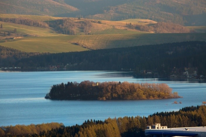
Orava reservoir
Ideas for the construction of a dam located in the Upper Orava Basin date back to the 19th century. In 1941, plans turned into action. Work on the dam lasted until 1953. As a result of the construction of the dam several towns completely disappeared: Slanica, Ústie nad Oravou, Oravské Hámre, Osada and Lavkov, which was the settlement of Lower Štefanov. The part of Bobrov and Námestovo was also demolished. When the tank is filled completely, the water floods the surface of 35 km2 and the maximum depth is 38 m.
Slanický island of art
Slanický island of art it is a former hill, on which stands the church dedicated to the Exaltation of St. Cross and the Way of the Cross. There is also a cemetery and the tomb of the Klinowski family. The hill was located above the sunken village of Slanica. In 1971, the exhibition of traditional folk art from the collections of Galeria Orawska was opened here, which is taking care of this exhibition all the time. Inside the church there is an exhibition titled “Slovak traditional folk sculpture and painting” and on the outside there was a lapidary on the island tittled “Orava Stone Sculpture of the 18th and 19th Centuries”.
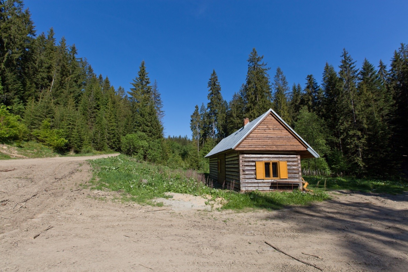
Stable
The wooden building called “koniareň” is located in the forests above the village of Klin. Important place for foresters served as a night shelter for employees and at the same time as a stable for horses. The building is run by the town of Klin, who recently restored the building.
Chapel of the Immaculate Heart of the Blessed Virgin Mary.
It is located on the border of the towns of Oravský Veselý and Sihelny near the road that connects the mentioned towns. The chapel has been restored in the recent past. In the niche of the chapel dedicated to the Immaculate Heart of the Blessed Virgin Mary is the sculpture of the Virgin Mary.
Chapel of Saint Joseph
The roadside chapel of St. Joseph is located at the intersection of the main road leading through the Orava Veselé and the road to Sihelny. A small brick building was crowned with a small turret with a helmet in the shape of onion.
Church of Saint Elizabeth
In 1656, a wooden church was built in Oravské Veselé, and Saint Elizabeth became its patron. The brick church, which stands until today, was built from 1805. The construction was completed in 1815. The church has classicistic style elements and was modified and rebuilt several times.
Cyrilometodic double cross
In 2013, in the area of Oravské Veselé on Grapa, a 12-meter-high iron-concrete Cyrilometodic cross was erected. Cyrilometodic cross is the national symbol of the Slovaks and points to the Cyrilomethodean traditions of Slovakia.From the Grapa hill (876 m above sea level) you can admire the beautiful views of the surrounding land.

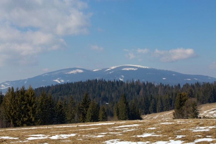
Pilsko
Pilsko – one of the majestic peaks of a microregion High Orava which is situated on a border with Poland. With its 1557 m a.s.l. it is not less known than its higher „sister“ Babia hora. Pilsko is a part of a massive of Orava Beskydy and Polish Zywiecke Beskydy. According to the area Natura 2000 it is a considerable teritory. Nowadays the Slovak part of Pilsko is situated in a zone A with the highest degree of protection in Protected landscape area Hight Orava. As regards land registry it is in the area of villages: Mutne, Namestovo /Namestovo Pilsko/ and Oravske Vesele.
Read more
Like other mountains on a Polish-Slovak border, also Pilsko forms a border between a sea-drainage area. Streems from the north slopes belong to the sea-drainage area of Baltic Sea, while those from south slopes belong to the sea-drainage area of Black Sea. Pilsko is within Enxiromental West Carpathians. The activity of an iceberg was more active in the north part what can be seen in sharper slopes than in the south.
As reagrds geology Pilsko belongs to flysch area formed with permeable layers of argilics and grit that were created in older cainozoic. A dominant of Orava Beskydy Pilsko and Babia hora, also Orava Magura are created with so called Magura grit that gets to the surface mainly in the top of Babia hora. In the south-west and west part of the peak over the area of wood there are indifferent stony seas with frost klips. These sees were formed with frost aeration. The slope erosion-induced rain is under way this time and it is characteristical with soil climbing or soil rinsing.
As regards climate Pilsko falls under cold climatic area with average July temeperatures from 10 to 12 degrees Celsia. Average anual aggregate of precipitations are cca 1600 mm. As regards soil there are acid or very acid soils poor in nutrients. It reflects in flora and fauna.
According to fytogeographic classification the area of Pilsko belongs to west-carpathian flora, a district of West Beskydy. A considerable part of the area is covered by beech woods – fir and spruce altitudinal zone, with wildwood complexes, with well-preserved forests in spruce and dwarf pine altitudinal zone. Beech, fir and spruce dominate in the forests. Dwarf pines dominate on the top of Pilsko.
In a plant undergrowth you can see most kinds of original beechwood, like: Dentaria glandulosa, Tithymalus amygdaloides, Asarum europaeum, Daphne mezereum, Anemone nemorosa. In acid beechwood there are kinds of mountainous pine grows, like: Homogyne alpina, Athyrium alpina with typical kinds of beeches. Predominant parts of the area are occupied by mountinous 200 years old pine grows. In a grass stand you can see rastie Vaccinium myrtillus, Homogyne alpina, Dryopteris dilatata, Avenella flexuosa. In the lowest part there are free places of briophytes: Polytrichum, Rhytidiadelphus and others. Over the wood zone, in a dwarf pine, there are free places of Juniperus communis subsp. alpina, Calluna vulgaris, Vaccinium myrtillus, Vaccinium vitis-idaea, Homogyne alpina or Senecio subalpinus.
The most important flora of this zone are: Diphasiastrum alpinum, Gentiana punctata, Sempervivum alpina and Hieracium alpinum. In the area of Mechy there are spacious areas of petroflows which are an evironment of „dwarf“ goat willows, for example Salix retusa. In the peak part there are mountain meadows of Nardus stricta. In the territory of Pilsko there are many small mosses that are one of the highest located in Orava. From botanical kinds an alpine bilberies is the most extraordinary kind.
Along currents and streams you can find a kind of European importance – Aconitum firmum subsp. moravicum. In lower locations in pine grows Aconitum firmum subsp. moravicum, Fragaria vesca, Carex pilulifera and Carex pilulifera grow. Along mountain currents and streams mountain alder-trees are preserved. They are isolated from other woods. Tree floors are formed with Alnus incana, Padus avium and Salix fragilis. In their shades other kinds, like: Viburnum opulus, Frangula alnus and other kinds of willows live. In alder-trees this location is much-favourite by Petasites albus, Petasites hybridus, Symphytum officinale and Caltha palustris.
As regards representatives of Pilsko fauna, the well-known and typical animals for this area are: red deer (Cervus elaphus), wild boar (Sus scrofa), roe deer (Capreolus capreolus), red fox (Vulpes vulpes), pine marten (Martes martes), least weasel (Mustela nivalis), stoat (Mustela erminea), red squirrel (Sciurus vulgaris) and brown hare (Lepus europaeus). In few isolated cases an elk appears close to Pilsko. It comes from near Poland. As regards big beasts of prey in Pilsko there is an abundant emersion of gray wolf (Canis lupus). Its individuals form wolfpacks of three up to seven wolves. The wolf has an appropriate conditions for living as population of red deer and wild boar and its natural prey is generally on a rise. Brown bear (Ursus arctos) and Eurasian lynx (Lynx lynx) do not occur in Pilsko very often.
Little ground mammals live here too. You can find here wood mouse (Apodemus sylvaticus), yellow-necked mouse (Apodemus flavicollis), bank vole (Myodes glareolus), common dormouse (Muscardinus avellanarius) and northern birch mouse (Sicista betulina). Predators, like: northern goshawk (Accipiter gentilis), northern sparrowhawk (Accipiter nisus), common buzzard (Buteo buteo) are in Pilsko too. Golden eagle (Aquila chrysaetos) flies here as well. Woods of Pilsko provide good nest conditions also nigh hunters – owls, like: tawny owl (Strix aluco), Eurasian pygmy owl (Glaucidium passerinum) or valuable boreal owl (Aegolius funereus).
Pilsko is one of the last asylum for valuable kinds of wood gallinacean birds – western capercaillie (Tetrao urogallus), that loves peace and quiet od Pilsko spruce woods. It is one of our biggest kinds of birds and one of the most endangred. Adult individuals live in winter time on nearly explicitly spruce-needles and fir-needles. In a vegetation period their food consists of young buds of raspberries, blueberries and sometimes insects. Youngs of western capercaillie (Tetrao urogallus) live on them till they grow up.
In old spruce woods also black woodpecker (Dryocopus martius), three-toed woodpecker (Picoides tridactylus), great spotted woodpecker (Dendrocopos major) or ring ouzel (Turdus torquatus) live. There are amphibians, like: fire salamander (Salamandra salamandra), Carpathian newt (Lissotriton montandoni) and alpine newt (Ichthyosaura alpestris) in mountain-streams and moors. Snakes are represented by common adder (Vipera berus) and grass snake (Natrix natrix), lizards by slowworm (Anguis fragilis) or common lizard (Zootoca vivipara).
Invertebrates are highly represented. Fauna of spiders is rich and some kinds live in higher mountain zones. The noticeable group of insects are butterflies that live in Pilsko. Among diversified Nymphalidae family belong: peacock butterfly (Aglas io), Camberwell Beauty (Nymphalis antiopa), red admiral (Vanessa atalanta) or there are also other families representatives like pale clouded yellow (Colias hyale), common brimstone (Gonepteryx rhamni) and orange tip (Anthocharis cardamines). Pilsko has also valuable kinds of beetles, e.g.: Palaeocollidium coriaceum, or a mountain kind of Atrecus longiceps. Nowadays there are, unfortunatelly, many kinds of wood-borers, like: Ips typographus (European spruce bark beetle), Pityogenes chalcographus, Dendroctonus micans (great spruce bark beetle) or Xyloterus lineatus. Mass outbreak is caused mainly by gale disaster that hit Pilsko in the past and made suitable conditions for the wood-borers.
Pilsko is one of two marked peaks of Orava north horizon, seen from the ridge of Orava Magura. The peak is very interesting for tuourists where there is a nice view on a region Orava and other ranges of West Tatras, Chočské vrchy and Little Fatra. The peak of Pilsko is possible to be reached from Slovak part along tourist paths following blue mark from a mountain gap Hliny and Sihelné, or a green mark from Oravske Vesele. The climb takes 2 ½ hours and it is not extremely demanding.
Unfortunately, like all natural uniques, Pilsko is endangered not only by natural disasters but also by negative influence of a human factor in a form of developer´s interests, illegal and feelingless collection of berries, law-breaking of traffic ban, disturbance, environmental demages of fauna and flora in a vegetation period by cars, motorbikes, four-whealers and in winter by snowmobiles.